Mr. Bruce Finley, of the Denver Post, recently wrote an article decrying:
While Mr. Finley’s (who was a Fulbright scholar in Britain and has a journalism degree from Northwestern University) statement that there was 19% imperviousness in 1974 and 48% coverage today statements may be correct, he sloppily points a lazy finger at dense development downtown without first checking the facts, using arbitrary pictures of downtown to supposedly illustrate the story of density being the culprit:


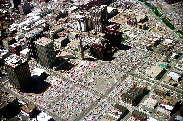
Unfortunately, Mr. Finley did not fact check where impervious development specifically occurred and what these areas looked like before 1974, which also happened to be impervious and looked like this:
Ask most urban planning academics for their thoughts on the actual cause of “development eats away at Denver’s green space” (including Mr. Muller- who was quoted in the article -I would contend), and they can point Mr. Finley in a much more accurate direction that has been ubiquitous for America -> sprawl & single family residences (86.2% of Denver’s residential land use) and the car infrastructure needed for a single family home lifestyle (parking, asphalt roads, and garages).
So what are the facts and what does the data say?
Here is the breakdown of impervious area parcel development since 1974 in Denver:
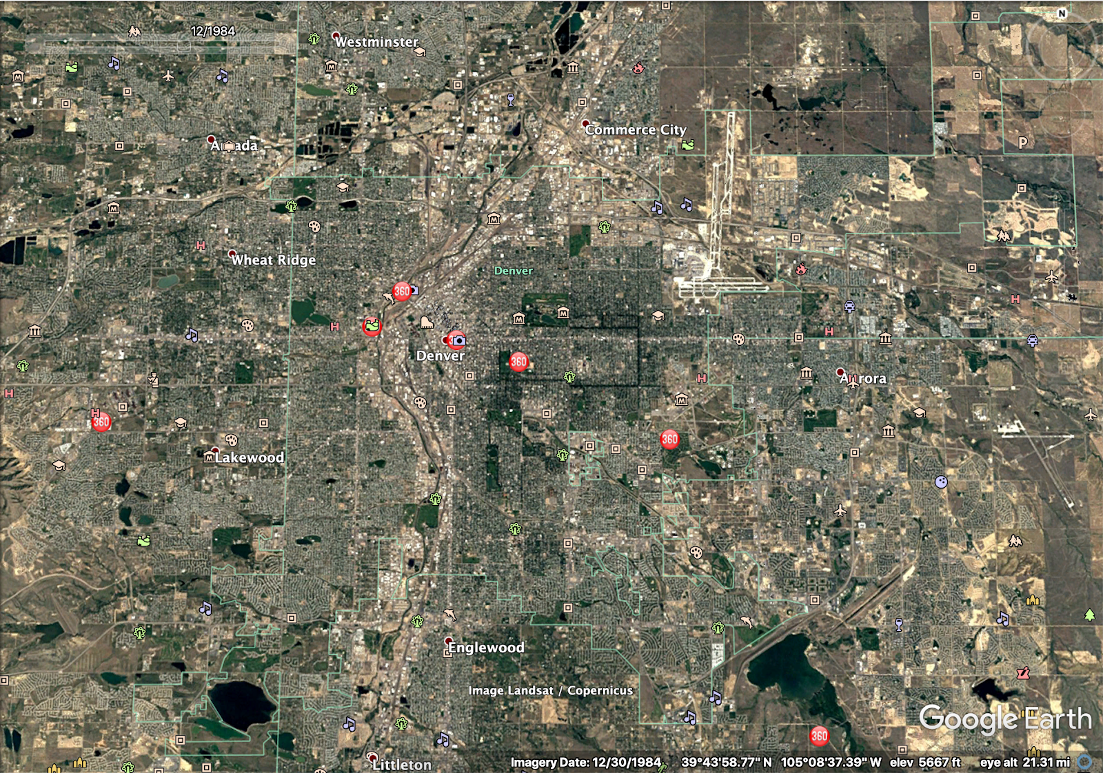
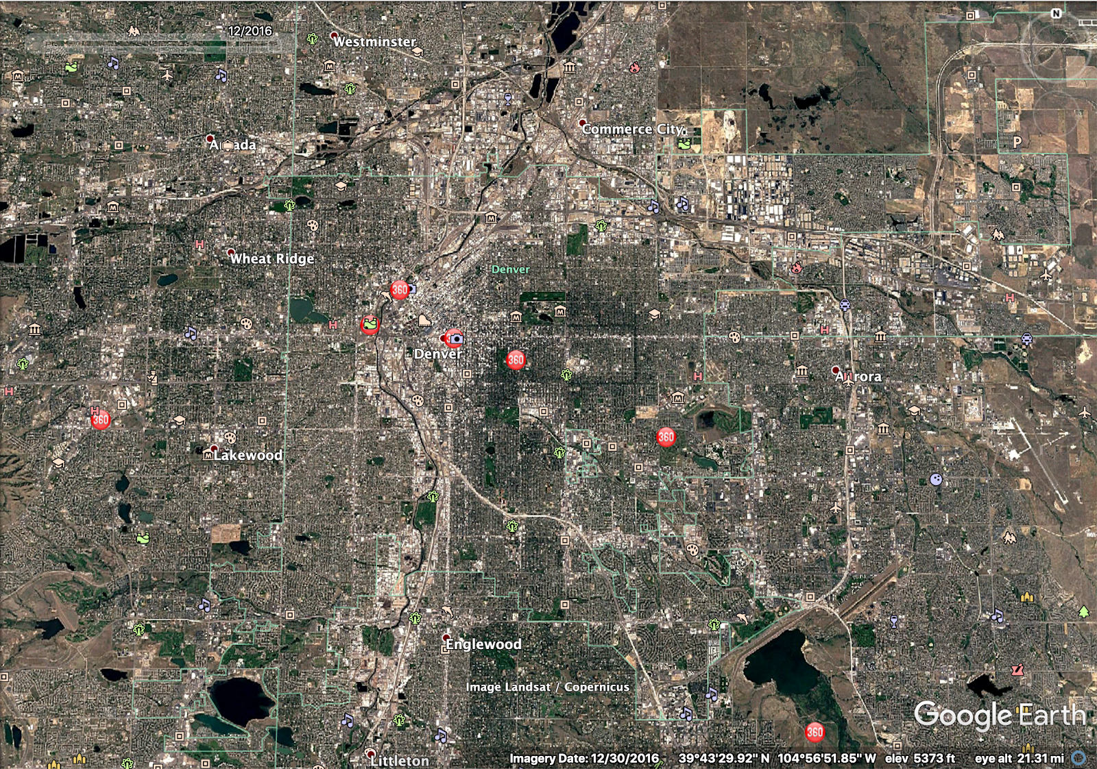
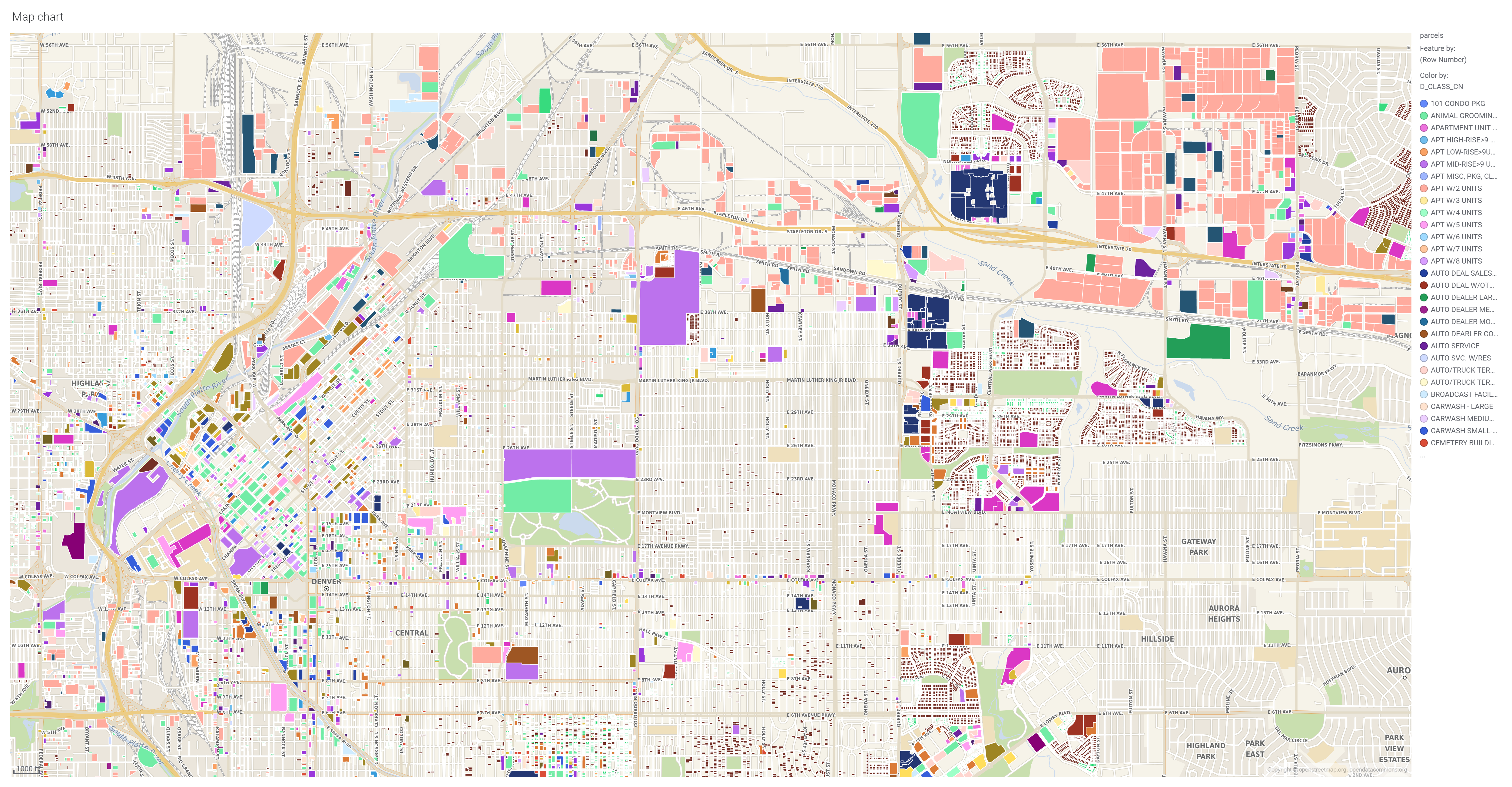
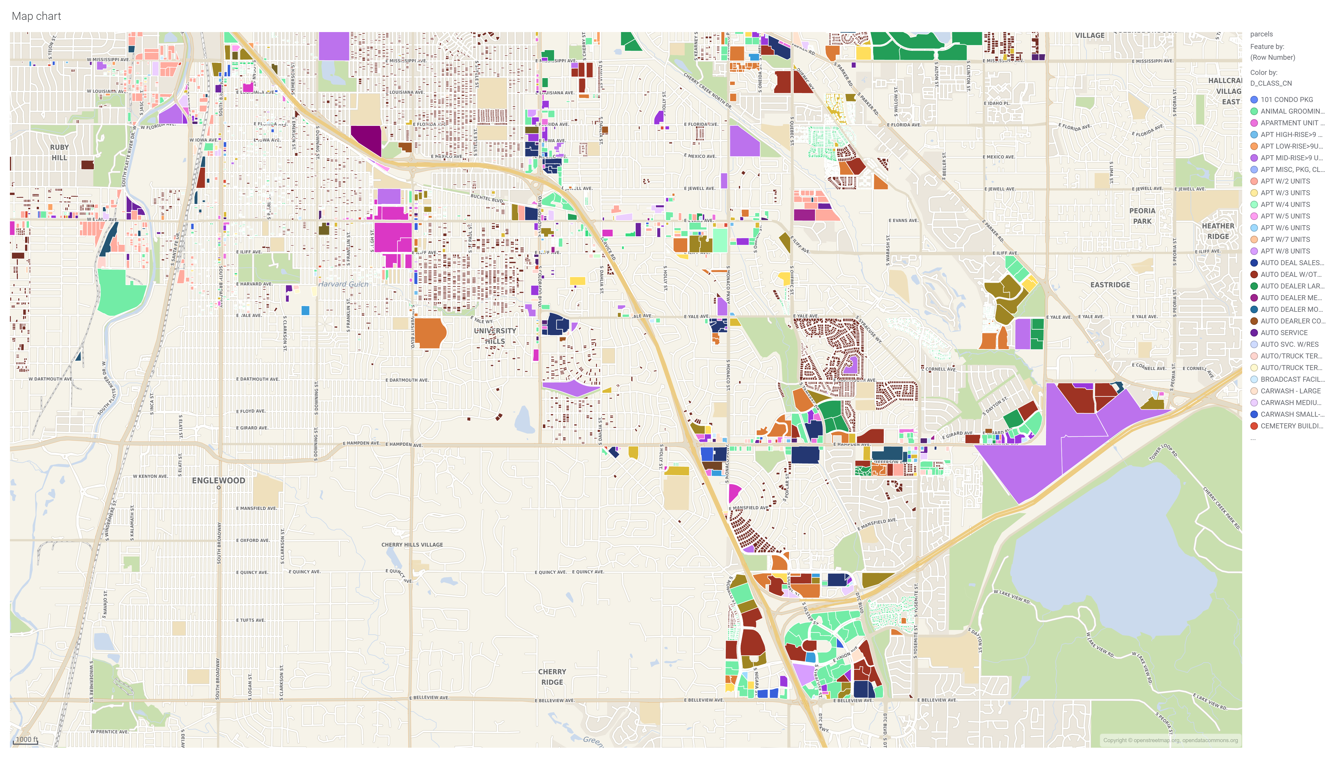
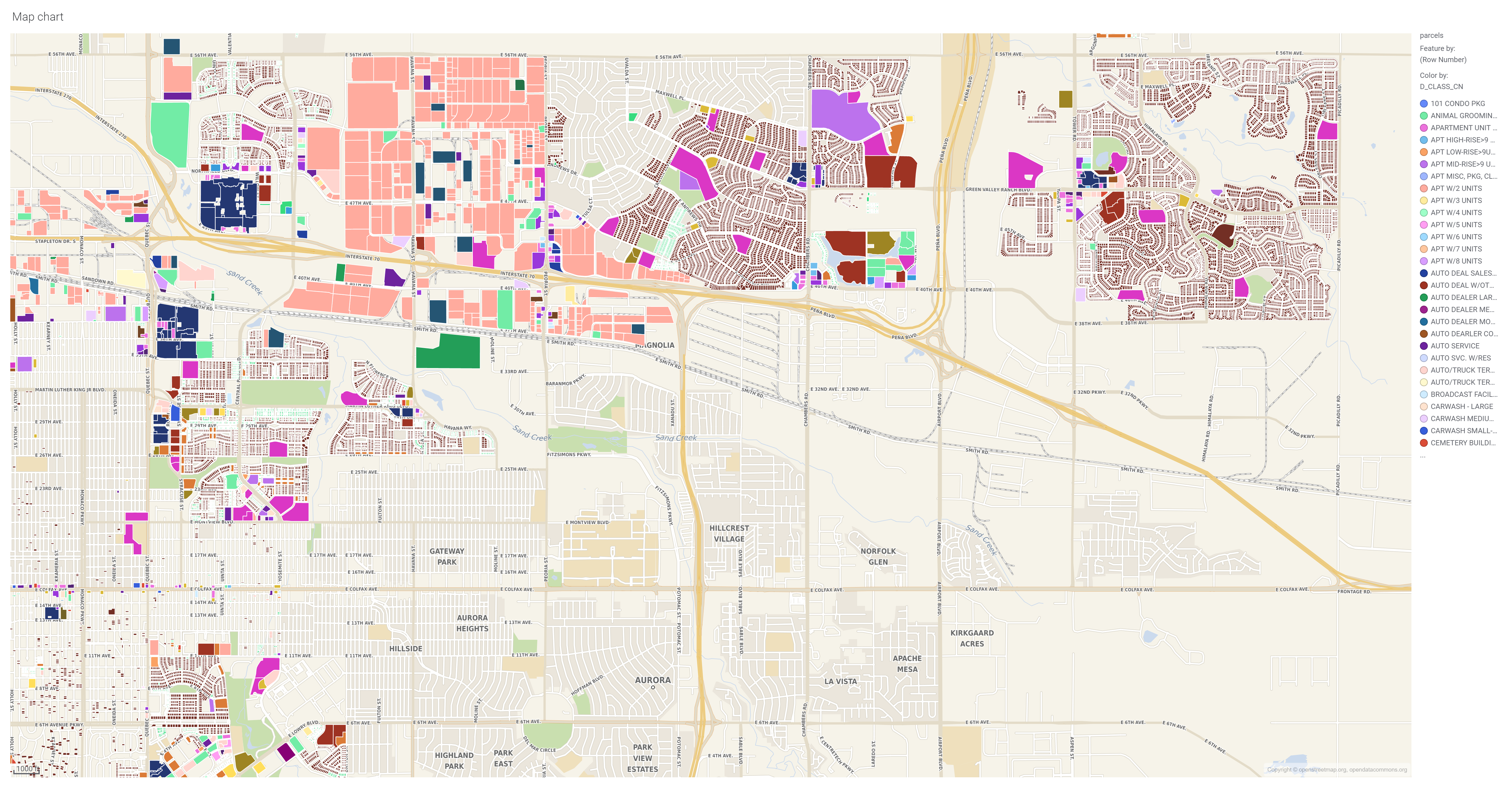
Where exactly has this development happened?
Many long time Denver residents can probably intuitively help Mr. Finley along with where development has focused over the last 5 decades. I’ll give you a hint on some really big ones… the redevelopment of Stapleton Airport, DTC, Green Valley Ranch, Montbello, and SW Denver into largely single family homes.

Interestingly, Mr. Finley did not comment on the fact that the amount of Park Space protected by Denver has actually increased over this time as well.
Ultimately, when a resident is physically unable to walk to a coffee shop in a single family neighborhood, one will need car-sized parking spaces and car-sized impervious roads to every conceivable destination. If we want to accurately investigate the decline of green space in Denver, we need to correctly point the finger at spread out, single family, suburban style neighborhood sprawl and the car infrastructure tied to it.
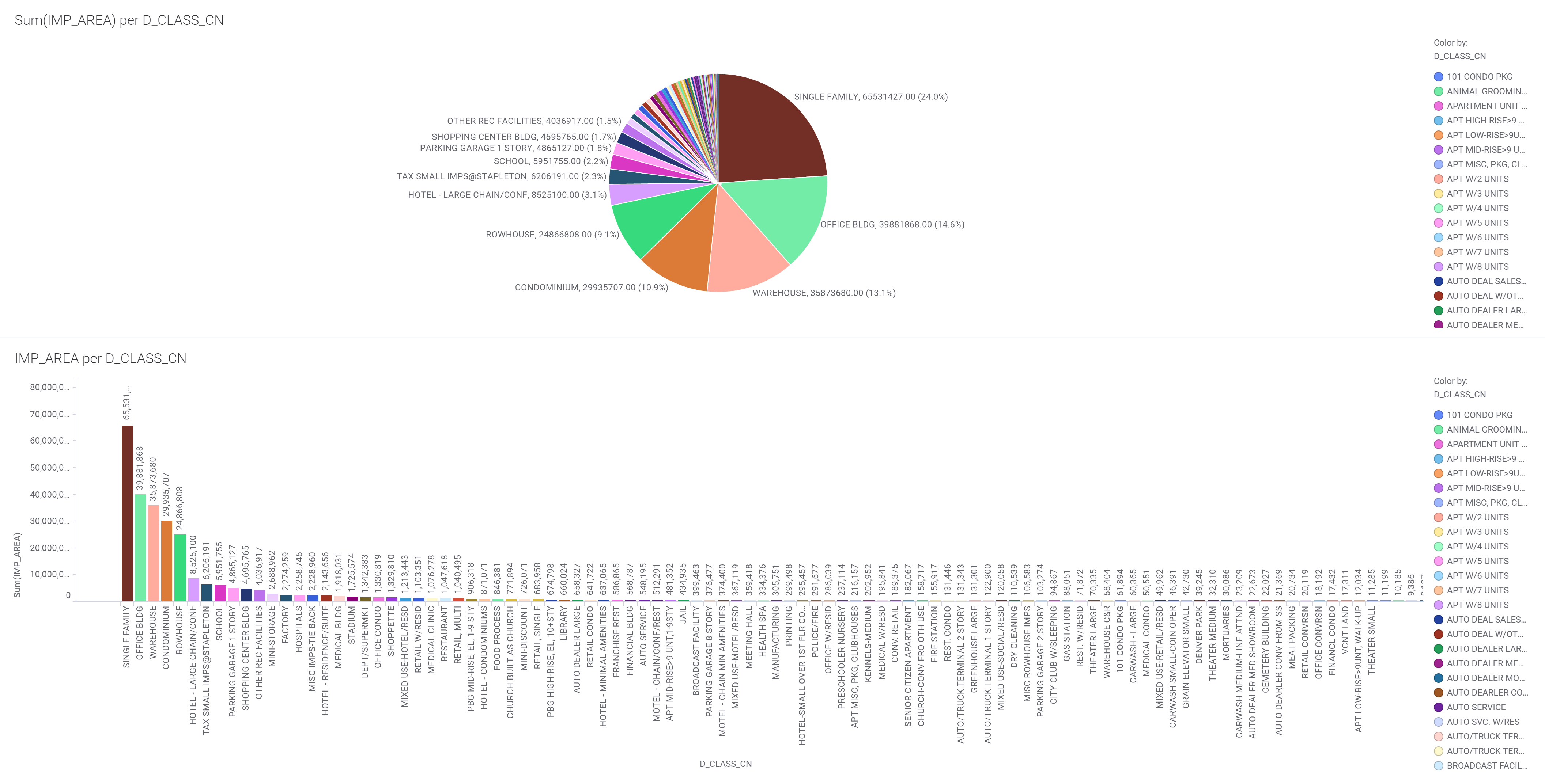
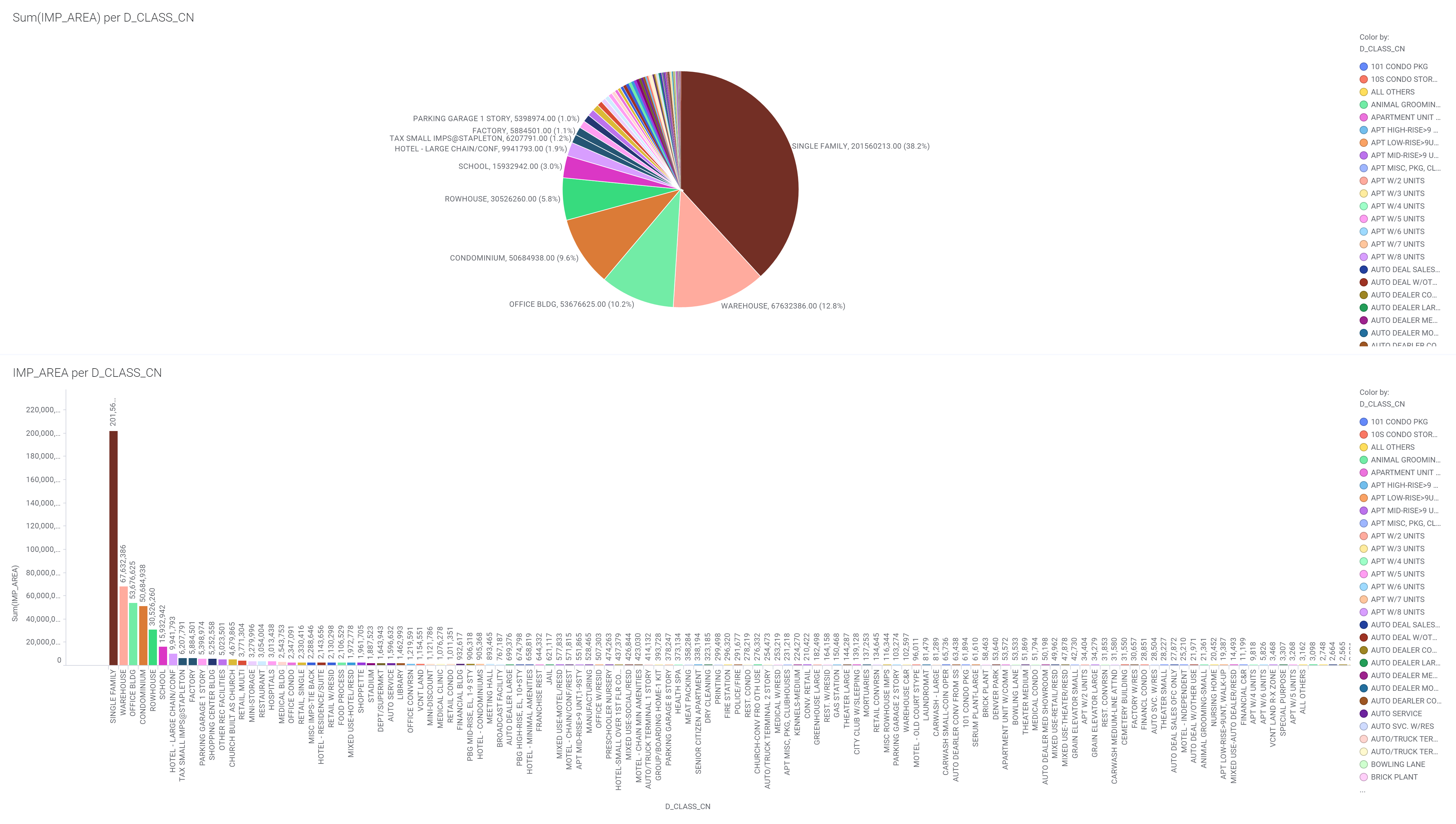
Lastly, regardless of construction date, here is Denver’s parcel impervious area by land use:
Additional Bonus Satellite Pictures: